One of my favorite destinations for hiking is the Mount Hood National Forest. First of all, it’s a volcano! How cool is that?! Ok, not so cool if it were to erupt, but it’s been dormant for over 220 years and scientists say the chance of an eruption any time soon is low. It’s also home to 12 named glaciers and snowfields. That means a lot of the hikes pass by water sources making it easy to refill your water bottle.
With just over 1 million acres, it’s no surprise there are so many trails to choose from. The terrain, difficulty, and attractions also vary wildly depending on which trail you choose. Whether you want to cool off next to a waterfall, hike part of the iconic Pacific Crest Trail, see snowfields in July, or explore dense forests, there’s a trail for you.
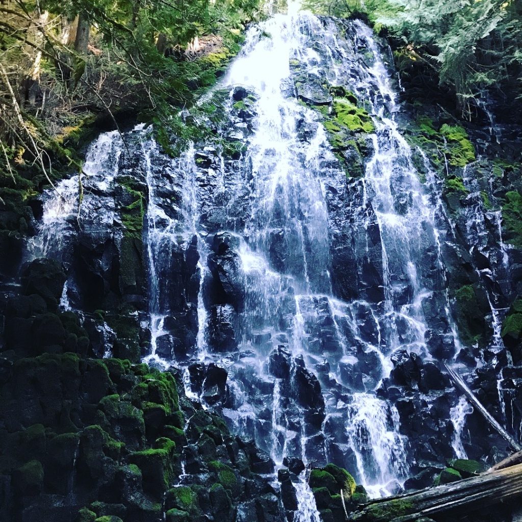
Ramona Falls
Length: 7.1 miles | Difficulty: Moderate | Elevation Gain: 1,046 ft
AllTrails
This popular trail is not only a great hike, it’s also a great trailhead to start longer hikes from. You’ll start with an easy stroll through the trees for just over a mile before you come to the only potentially difficult part of this trail, crossing the Sandy River. There is no bridge, but there are plenty of downed trees that can be used to find a safe path across. I’ve seen hikers of all ages and even dogs crossing without a problem. Sometimes the path you see others taking is the best option, but don’t be afraid to walk a little farther up or down river to find a safer and/or easier option. This is also a spot where hiking poles can come in super handy!
Once you’re safely across the river there’s an open area that, on a clear day, provides a beautiful view of the peak of Mt Hood. It’s a great spot for a photo to make your friends jealous. Continuing on you’ll come to a split that offers 2 options. To the right, you’ll hike along a section of trail that is part of the Pacific Crest Trail, with views of the river. If you choose to go left at the split, you’ll find yourself snaking along a creek with plenty of shade and greenery.
Regardless of which way you choose to go, you’ll end up at the same amazing halfway point. Ramona Falls. It’s a beautiful waterfall with a huge area to stop and have a snack, refill your water bottle, and snap some photos. There are even primitive spots to camp nearby, just be sure you’re at least 500 feet from any water source.
Tips:
- Get there early before the trailhead parking lot fills up
- Be sure to buy your pass before you arrive or bring cash to use at the trailhead. A single day pass is only $5 and you only need 1 pass per vehicle. The Zig Zag Ranger Station is a great place to grab a day pass on your way to the trailhead.
- The road to the trailhead gets pretty rough, especially the last 1/4 mile, so if you have a truck or SUV it’ll be a little easier getting there.
- Read the latest reviews on AllTrails or check the USFS site for conditions before you go. There’s a gate that gets closed during the winter and doesn’t usually reopen until mid-May. You can still do this hike during the winter, but it adds an extra 2 miles each way to/from the trailhead.
Mirror Lake
Length: 4.2 miles | Difficulty: Easy | Elevation Gain: 672 ft
AllTrails
Mirror Lake is another popular trail that’s great for when you want an easy trail that’s still packed with natural beauty. As soon as you set out you’ll find yourself strolling through a beautiful, green forest, crisscrossing a babbling creek on wooden footbridges. Each one is a great opportunity for a photo to remember your adventure.
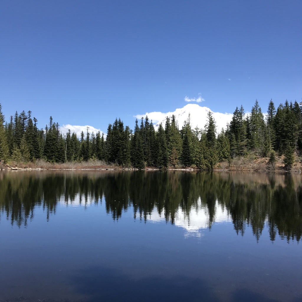
About 2 miles later you will come to a split in the trail just before you reach Mirror Lake. It’s a loop that takes you around the whole lake so there’s no wrong way to go. If you’re looking for shade, head to the left. If you want to enjoy the sun or check out the first-come-first-served campsites, head to the right. Also on the right, farther down, the trail splits and heads back into the woods. If you’re curious what that’s all about, check out the next hike in this article!
So where does this trail get its name? Well, if you visit on a clear day head to the opposite side of the lake and turn around. Look up and you’ll see the snow-covered peak of Mount Hood above you. Look down and you’ll see the peak’s reflection in the lake, as if you were looking in a mirror. Be sure to take a photo so you can show your friends and explain how it doesn’t begin to do justice to how beautiful it is in person.
Tips:
- If you visit between November 1st and April 30th, you’ll need a Sno-Park Permit to park at the trailhead.
- If it’s been a while since you hiked this trail, the trailhead was relocated in 2018. You’ll find it next door to Ski Bowl West on Hwy 26, and it includes pit toilets and more parking than the old trailhead!
Tom, Dick, and Harry Mountain Trail
Length: 9 miles | Difficulty: Hard | Elevation Gain: 1,709 ft
AllTrails
If you enjoyed the Mirror Lake trail, or wish it were a little more challenging, the Tom, Dick, and Harry Mountain Trail is what you need. The first 2 miles (and last 2 miles) of the Tom, Dick, and Harry Mountain Trail is actually the Mirror Lake trail you read about above.
So you get to see everything on that trail, and then kick it into high gear for a decent workout, followed by amazing views at the top. On the west side of Mirror Lake the trail splits, taking you into the woods where you start climbing. It alternates between a gradual rise and sections that are almost straight up.
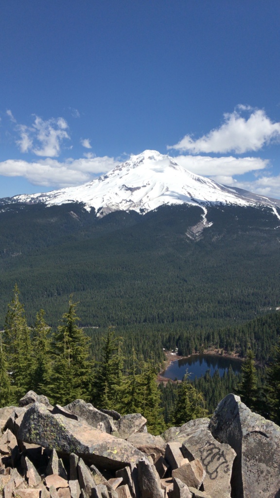
The last push to the top is the hardest, but totally worth it once you finally emerge at the rocky summit. There’s plenty of room to find your own space to take a well-deserved break for water and a snack while you soak in the views. Keep an eye on your food though, because sneaky chipmunks will be scampering around hoping to snag their next meal.
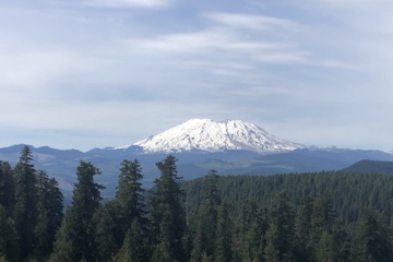
Depending on how clear it is you can see several other peaks in addition to Mount Hood, including Mount Rainier, Mount Saint Helens, Mount Adams, and Mount Jefferson. Below you can see Mirror Lake which gives you a great perspective on just how high you climbed, although that will probably be clear from how your legs are feeling.
McNeil Point
Length: 8.5 miles | Difficulty: Hard | Elevation Gain: 2,585 ft
AllTrails
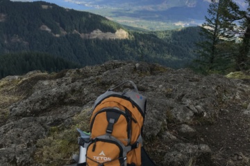
The first hike I did in Mount Hood National Forest was to McNeil Point via the Top Spur trailhead. I didn’t realize it at the time, but it was a bold choice for my first time there. The Top Spur trailhead can be a little difficult to get to with the narrow winding gravel forest roads, splits with no signs, and no cell service. But that means you’re starting deeper in the forest and there are far fewer people around than at the more popular trails.
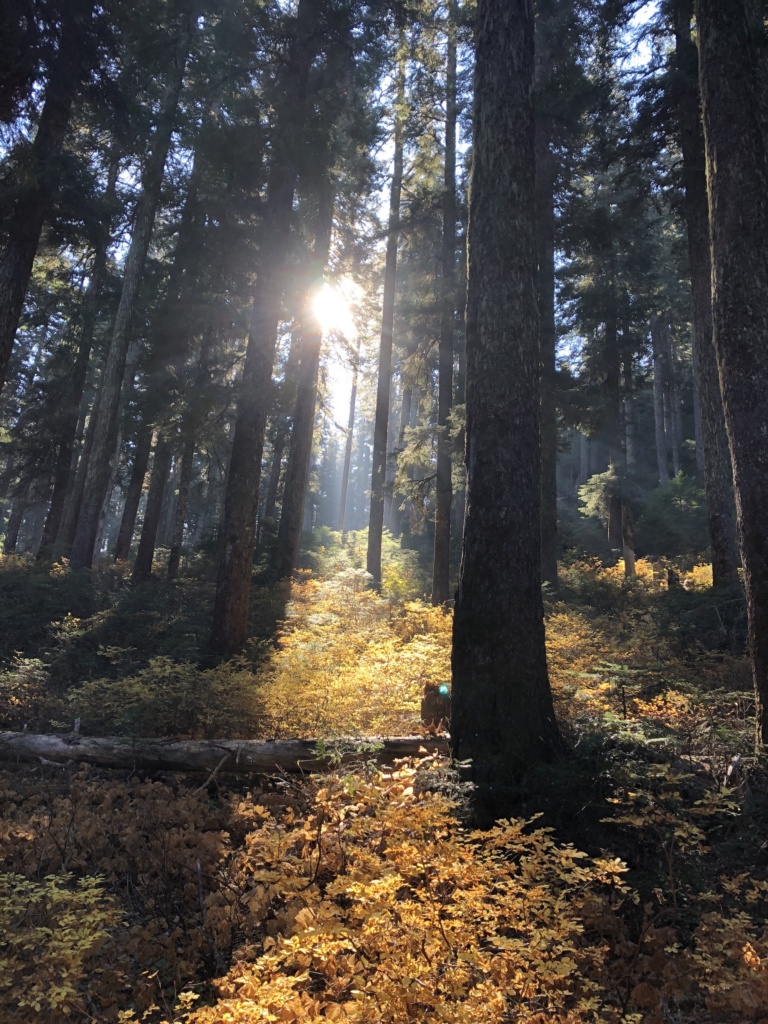
I vividly remember the first 1/2 mile of this hike. The dense forest with the sun shining through, fall colors all around, and the beautiful silence that only exists when you are alone in nature. Soon after you begin, you’ll come to a trail merge and spend some time on the Timberline Trail (which you’ll learn about next). 1.7 miles later you’ll come to the loop portion of this hike. The main trail continues to the left and is the direction most people choose. The return trail is easy to miss if you don’t know what to look for, but it will be clear when you come down that section later.
As you continue to the left you’ll go through a meadow then start to climb. There’s a certain point where you round a corner and finally Mount Hood’s snow-covered peak comes into view. This will likely be the closest view you’ve ever had of the peak, and it’s breathtaking. When you reach the top you’ll find an old stone shelter and plenty of spots to rest and enjoy a snack while you take in the view.
The Timberline Trail
Length: 41.4 miles | Difficulty: Hard | Elevation Gain: 10,341 ft
AllTrails
If those trails seem a little too tame, how about hiking around the entire mountain? That’s exactly what you’ll do on the Timberline Trail. It’s a 41 mile trail that circumvents Mount Hood and covers over 10,000 feet of elevation gain. Depending on your skill level and hiking speed, this will probably be a 2-4 day backpacking trip.
Some common starting points for this hike include the Ramona Falls Trailhead, Top Spur trailhead, and Timberline Lodge. The lodge has the most parking of these options by far, and food options if you finish during the day and want a good meal.
If you’re want to really connect with nature, this is the trail for you. Hike by glaciers and waterfalls, ford rivers, and sleep in the wilderness, and take in amazing views of nearby. Spend 2 or more days surviving with only what you can carry on your back while enjoying some of the most beautiful nature the PNW has to offer.
Conclusion
Regardless of your skill level, you should now have at least 1 or more new hikes to check out when you visit the Mount Hood National Forest. Of course, there are plenty of other nearby trails, many of which connect to some of the trails that you just read about. Whatever you choose I’m sure you’ll have a great time!
Remember: Whenever you head out for a hike, always:
– Download offline maps in case you don’t have cell service
– Pack the Ten Essentials
– Follow the Leave No Trace principles
0 Comments